The below timeline covers many of the milestones in the story of lidar. For sourcing and more detail, see “The Laser That’s Changing the World,” which is footnoted to the hilt.
Pre-1950
1917 | Einstein proposes stimulated emission, the theoretical basis for laser light.
1930 | E. H. Synge publishes Philosophical Magazine paper on investigating the upper atmosphere with searchlights, positing for the first time a way to probe the heights without sending an instrument up (in this case, the heights would eclipse what anything short of a modern rocket could attain anyway).
1935 | Carnegie Institution/USDA scientists do lab experiments on the idea, conclude that it could work up to 70 km/43 miles.
1937 | Edward O. Hulbert, Naval Research Laboratory scientist, does first searchlight experiment; film picks up traces up to 28 kilometers/17 miles.
1939 | Ellis A. Johnson, Carnegie Institution Scientist who had worked on the 1935 lab experiment, uses a searchlight to capture signals up to 40 km/25 miles. Observes upper atmospheric change during the experiment; posits that, with adjustments, the approach could determine ozone distribution based on how ozone molecules reflect the light—essentially long-distance spectroscopy.
1940 | British share cavity magnetron invention with Americans; Americans establish MIT Radiation Laboratory to develop them for radars desperately needed in the war effort.
1950s
1953 | Columbia University team led by Charles Townes build the first maser (microwave amplification by stimulated emission of radiation), the first manifestation of Einstein’s stimulated emission theory.
1958 | Townes and Arthur Schawlow publish Physical Review paper “Infrared and Optical Masers,” proposing a way to harness stimulated emission using light.
1960s
1960 | Robert H. Dicke and colleagues propose tracking satellites using corner cube retroreflectors.
1960 | Theodore Maiman, a Hughes Aircraft researcher, demonstrates the first laser
1961 | Hughes builds first prototype lidar (a.k.a. laser radar)
1962 | Hughes brings the first commercial lidar to market, the Hughes Mark II Colidar.
1962 | MIT scientists Louis Smullin and Giorgio Fiocco shoot the moon with a laser for project Luna See.
1962 | Princeton physics PhD student James Faller floats the idea of placing corner-cube retroflectors on the moon for the study of gravity.
1963 | Fiocco and Smullin follow up with atmospheric experiment, reporting returns from up to nearly 130 kilometers/81 miles.
1963 | Myron G. H. “Herb” Ligda and Dick Honey of SRI build the SRI Mark I lidar for atmospheric studies, detecting cloud, smog and haze layers in the lower atmosphere. Ligda and successor Ron Collis do pioneering lidar work for the next several years, focusing on aerosols – fog, dust, pollen, steam, haze, smoke, smog, clouds – weather radar can’t see.
1964 | Richard Schotland measures water vapor using differential absorption lidar (DIAL).
1964 | Henry Plotkin’s NASA Goddard Spaceflight Center team does the first satellite laser ranging, bouncing light from ruby laser off corner cube retroreflectors on Beacon 22.
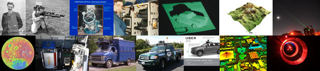
1966 | MIT Lincoln Laboratory’s Firepond lidar experiment launched to try and discern incoming nuclear warheads from decoys; cancelled in 1981.
1968 | Warren Johnson and Ed Uthe of SRI use portable SRI mark V lidar to track Keystone Generation Station’s smokestack plume.
1968 | George D. Hickman flies the first bathymetric lidar over Lake Ontario.
1969 | Apollo Lunar Ranging Experiment (LURE) lands on the moon with Apollo 11.
1969 | The U.S. Navy tests its Pulsed Light Airborne Depth Sounder (PLADS) from a helicopter; a classified Naval Air Development Center program to probe the depths is flown at about the same time.
1970s
1971 | The first lidar in space, a lunar altimeter built by RCA, flies on Apollo 15.
1972 | Laser-guided bombs take out Dragon’s Jaw bridge at Thanh Hoa during Vietnam War.
1973 | NASA Wallops Facility scientist Hongsuk Kim, working with Dan Hickman, builds a bathymetric lidar flown on a NASA DC-4 aircraft for both depth sounding and fluorosensing. This is the predecessor to the NASA Wallops Airborne Oceanographic Lidar, a collaboration between NASA, the Navy, the Defense Mapping Agency and NOAA.
1974 | York University (Canada) physicist Allan Carswell and his wife Helen found Optech.
1975 | The NASA Wallops Airborne Oceanographic Lidar (AOL) program, a collaboration between NASA, the Navy, the Defense Mapping Agency and NOAA, kicks off.
1975 | An Australian team led by Michael F. Penny flies WRELADS, (Weapons Research Establishment Laser Airborne Depth Sounder).
1975 | French Starlette satellite, the first devoted solely to satellite laser ranging, launches.
1976 | NASA launches LAGEOS for satellite laser ranging, a bigger, heavier, higher-flying version of Starlette.
1977 | First flights of the NASA Wallops Airborne Oceanographic Lidar (AOL).
1977 | The Environmental Research Institute of Michigan (ERIM) flies a lidar capable of differentiating a tank from a photo of one from an aircraft.
1978 | Johannes Riegl founds Riegl to build on technology he began working on at the Vienna University of Technology in 1968.
1978 | First test flight of Ed Eloranta’s high spectral resolution lidar (HSRL).
1979 | NASA Wallops AOL team map topography of the Wolf River Basin in Tennessee (without GPS).
1979 | Air Force Research Laboratory launches the Advanced Terminal Homing system (ATH) to study lidar in cruise-missile guidance. Follow-on Cruise Missile Advanced Guidance System (CMAG), started in 1983, eventually cancelled as GPS came to the fore.
1980s
1981 | H. Jay Zwally, Robert H. Thomas and Robert Bindschadler propose a satellite lidar to map polar ice sheets.
1981 | Simon Raab and Gregory Fraser found Res-Tec, which would become FARO. FaroArm, developed with Martin Marietta, comes to market a decade later.
1984 | Milton Huffaker founds Coherent Technologies to commercialize lidar wind-detection systems using the Doppler effect. Huffaker started working on the technology with NASA in the mid-1960s.
1984 | Optech’s LARSEN 500, the first operational lidar bathymeter, creates the first airborne-lidar-derived hydrographic chart, of Cambridge Bay in the Canadian Arctic.
1985 | A NASA Wallops team led by Bill Krabill pioneers the use of GPS in positioning a flying aircraft, an advance that would pave the way for airborne elevation mapping using lidar.
1985 | MIT Lincoln Laboratory launches second-generation Firepond experiment to discern incoming nuclear warheads from decoys.
1985 | Carnegie Mellon University’s Robotics Institute, Martin Marietta and an unnamed government agency each get an ERIM lidar, paid for by DARPA, for use on Autonomous Land Vehicle (ALV) program projects. At CMU, the lidar ends up on Red Whittaker-led Navlab 1, among other autonomous robots. Martin Marietta puts theirs on a 10-wheeled, 15,200-pound research vehicle.
1986 | U.S. Army Corps of Engineers researcher Jeff Lillycrop spurs what would become the SHOALS topo-bathy lidar program, which Optech builds.
1987 | Using a lidar Chester Gardner’s team designed to probe winds and temperatures of the upper atmosphere, Gardner and Laird Thompson light up the sodium layer with a laser, creating an artificial guide star (MIT Lincoln Laboratory researchers invented the same technology independently as part of a classified program).
1987 | Paul McManamon’s Air Force Research Laboratory team and contractors including Raytheon, HRL and Westinghouse begin serious work on optical phased arrays under the Beam Agility Techniques contract.
1989 | Laser Technology, Inc. introduces the first laser-based police speed gun, launching a commercial product in 1991.
1990s
1991 | NASA’s Airborne Oceanographic Lidar (AOL) makes first flight over Greenland. Later evolves into the Airborne Topographic Mapper (ATM).
1992 | Geiger-mode detectors based on MIT scientist Richard Marino’s research used on a side experiment during Firepond’s Firebird 1B test.
1993 | JALBTCX’s SHOALS topo-bathy lidar, built by Optech, flies; revolutionizes coastal mapping.
1993 | MIT Lincoln Laboratory scientist John Zayhowski invents the passively Q-switched microchip laser, which becomes a mainstay with Geiger-mode lidar as well as an enabler of the Cyrax 2400 3D scanner.
1993 | Engineer/entrepreneur Ben Kacyra and wife Barbara found Cyra Technologies with Jerry Dimsdale as the technical lead.
1994 | NASA Langley Research Center’s Lidar In-Space Technology Experiment (LITE) orbits with Space Shuttle Discovery.
1994 | NASA Goddard scientist David Harding’s talk on SLICER, a full-waveform lidar he co-developed, catches Goddard postdoctoral researcher John Weishampel’s interest. Weishampel alerts his University of Virginia advisor Hank Shugart, who shares the lidar’s potential in studying forest composition with PhD student Michael Lefsky.
1995 | Michael Raphael and Richard Lee leave Martin Marietta, buy a FaroArm Raphael helped develop, and found Direct Dimensions.
1996 | Mars Orbiter Laser Altimeter, or MOLA, launches with NASA’s Mars Global Surveyor; basis for lidar-based topographic map of a planet. (An earlier version of MOLA had launched on the ill-fate Mars Observer in 1992).
1996 | NASA Goddard’s Shuttle Laser Altimeter flies with Space Shuttle Endeavor in 1996 and Discovery in 1997. This was an early full-waveform lidar.
1996 | Lidar flights over Bainbridge Island show the Seattle Fault, previously undetected below the canopy.
1996 | Air Force scientist Paul McManamon and Raytheon publish seminal work on optical phased arrays.
1998 | NASA launches NEAR mission to Asteroid 433 Eros; lidar flies along for elevation mapping.
1998 | Cyra Technologies introduces the Cyrax 2400, the first tripod-mounted, commercial 3D scanner. It comes with Cyclone, the first integrated point-cloud software.
2000s
2000 | University of Texas at Austin team led by James Gibeaut create the first lidar-based digital elevation model of an archaeological site, at Copan, Honduras.
2001 | British researcher use lidar to do aerial scans of the region surrounding the Stonehenge World Heritage Site.
2001 | MIT Lincoln Laboratory scientist Richard Marino leads DARPA-funded Jigsaw program, which uses Geiger-mode lidar to see under tree canopies. Descendant systems include MACHETE and JAUDIT (Jungle Advanced Under Dense Vegetation Imaging Technology), which was renamed to TACOP (Tactical Operational Lidar).
2001 | NASA Goddard scientist John Degnan’s single-photon lidar, which emerged from his satellite laser ranging work, flies as the NASA Microlaser Altimeter.
2001 | Leica Geosystems buys Cyra Technologies.
2002 | Carnegie Mellon computer science professor Sebastian Thrun develops Simultaneous Location and Mapping (SLAM) software for Red Whittaker’s mine-mapping Groundhog robot.
2003 | NASA’s ICESat launches with the Geoscience Laser Altimeter (GLAS).
2003 | Canadian company Mosaic Mapping Solutions maps 350 miles of highway between Kabul and Kandahar, Afghanistan, using lidar.
2003 | Ben Kacyra and wife Barbara spin nonprofit CyArk to digitally preserve historic sites.
2003 | John Degnan, retired from NASA but working as Sigma Space’s chief scientist, designs Leafcutter, a second-generation single-photon lidar designed to fit in the nose of a UAV.
2004 | NASA’s Mercury MESSENGER mission launches with lidar evolved from MOLA.
2004 | DARPA Grand Challenge in the Mojave Desert ends with no finishers. SICK line scanners are a popular sensor among teams. Ford engineer/scientist Jim McBride and David Hall, whose Team D.A.D. used a stereo vision system, discuss the potential of a spinning lidar.
2005 | Sebastian Thrun’s Stanford Artificial Intelligence Laboratory (SAIL) entry, Stanley, wins the second DARPA Grand Challenge. David Hall’s Toyota Tundra fails to finish, but its spinning lidar becomes the basis for Velodyne’s HDL-64.
2006 | Joint NASA-French space agency CALIPSO atmospheric science lidar mission launches.
2006 | Sanjiv Singh’s Carnegie Mellon team builds a lidar enabling a remote-control helicopter to guide itself and avoid trees, wires and buildings.
2006 | John Ristevski and Anthony Fassero found earthmine; sell to Nokia in 2012. Combined with Navteq, also purchased by Nokia, becomes Here, a major street mapper.
2007 | Carnegie Mellon Field Robotics Center professor Red Whittaker’s Tartan Racing team wins the 2007 DARPA Urban Challenge. Velodyne HDL-64 are on his and other entrants’ vehicles.
2007 | Japanese SELENE and Chinese Chang’E spacecraft send lidars to the moon, followed by Indian Chandrayan spacecraft in 2008.
2009 | Lunar Reconnaissance Orbiter launches with the Lunar Orbital Laser Altimeter (LOLA). Heritage harks back to MOLA, MESSENGER and ICESat lidars.
2009 | University of Central Florida Archaeologists Arlen and Diane Chase, longtime Maya researchers, and John Weishampel, enlist the National Center for Airborne Laser Mapping (NCALM) to scan the Caracol site, Belize using an Optech aerial lidar.
2010s
2011 | CZMIL, the next-generation SHOALS top-bathy lidar, takes flight.
2011 | Google acquires 510 Systems, which designed the Topcon box atop Google street mappers.
2012 | Archaeologists Damian Evans and Roland Fletcher fly lidar over Angkor in Cambodia; documentary filmmaker Steve Elkins enlists NCALM to spot ruins under canopy of Honduran Mosquitia rainforest.
2012 | NASA JPL’s Airborne Snow Observatory (ASO) takes flight to measure mountain snow packs.
2014 | The U.S. Geological Survey launches its 3DEP program, which aims to upgrade U.S. elevation maps by using airborne lidar (except in Alaska).
2015 | NASA’s Cloud Aerosol Transport System (CATS) lidar launches to the International Space Station.
2015 | Harris Corporation unveils its Geiger-mode lidar, which can operate at 330 mph in a jet at 25,000 feet. It’s based on the technology Richard Marino and others developed at MIT Lincoln Laboratory.
2016 | Guatemalan Pacunam Foundation kicks off three-year lidar campaign to fly 14,000 square kilometers of Maya lowlands.
2016 | U.S. Federal Aviation Administration releases its Small UAS rule, opening the door for commercial drones weighing 55 pounds or less. Lidar-toting drones are now legal in the United States.
2017 | Leica Geosystems, which acquired Sigma Space in 2016, introduces the SPL 100, a single-photon lidar based on John Degnan’s technology. As with Harris Corporation’s Geiger Mode lidar, it can operate at 330 mph/25,000 feet.
2017 | Red Whittaker’s Carnegie Mellon Field Robotics Center team starts work with the U.S. Department of Energy on robots to inspect the interiors of pipes during nuclear-plant cleanup.
2018 | CyArk and Google launch Open Heritage to share the CyArk collection of digitally preserved heritage sites.
2018 | European Space Agency’s Aeolus mission launches with its ultraviolet Dopper lidar, the aim being to measure global winds.
2018 | NASA’s ICESat-2 launches.
2018 | NASA’s Global Ecosystem Dynamics Investigation (GEDI) to study global forest composition from the International Space Station launches.