
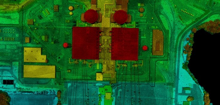
A lidar elevation map taken from an aircraft (courtesy Harris Corp. via SPAR 3D)
I was recently in touch with a writer friend of mine who lives in London. We’re both old enough that we emailed rather than Snapchatted or WhatsApped. I mentioned that I was writing a book about the history of lidar. He’s a wry type. He answered:
Yes, my first thought was “but surely there are already dozens of ‘definitive’ books on lidar?!?!”
My second thought was “what the eff is lidar and do i really need to read a whole book to find out?”
The email exchange went on to talk about England’s soccer fortunes and standard writerly quibbles about the editing process. But I couldn’t quite let those two sentences go. [more]